|
Most of this page consists of small versions of huge maps of the Moon, which serve as an overview of the maps available, and links to the larger versions. However, it seems appropriate to start the page with an outstanding mosaic of the lunar nearside.
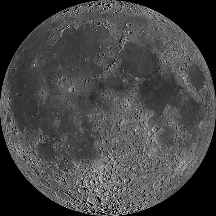
A lunar nearside mosaic (Image Credit GSFC / Arizona State Univ. / Lunar Reconnaissance Orbiter
NASA)
Usually, images of the full moon show no shadows and relatively little contrast, because we are viewing the Moon from the same direction as the Sun, and there are no shadows visible from our location. The above mosaic of thousands of Lunar Reconnaissance Orbiter images, adjusted for foreshortening (near the limb) and taken slightly away from local lunar noon (so that there are some shadows) provides an enhanced view of the lunar nearside similar to that in the best hand-drawn maps. The same image is also shown below, but with some of the more prominent features (easily visible with binoculars and at least detectable even with the unaided eye) labeled. 
Below, a lunar farside mosaic (Image Credit GSFC / Arizona State Univ. / Lunar Reconnaissance Orbiter
NASA)

Click on any map below to link to a (much) larger version
Color-Coded Topographic Maps of the Moon
(source: USGS)

Topographic map of the lunar near side

Topographic map of the lunar far side

Topographic map of the Moon, centered on "western" side

Topographic map of the Moon, centered on "eastern" side

Topographic map of the Moon, centered on the North Pole

Topographic map of the Moon, centered on the South Pole
Shaded Relief Maps of the Moon
(Source: Lunar and Planetary Institute)

Shaded-relief map of the lunar nearside

Shaded-relief map of the lunar farside

Shaded-relief maps of the lunar poles
|